


The definitive KML files of Spain!
Content
SITES OF SPAIN offers you the exact position of thousands of interesting places to explore in Spain: castles, palaces, sanctuaries, abandoned villages and constructions, archaeological sites, waterfalls, caves, singular buildings, etc. An essential tool to not miss a single one of the places of interest in Spain that will allow you to plan your trips, routes and excursions (whether real or virtual) in a much easier and more efficient way.
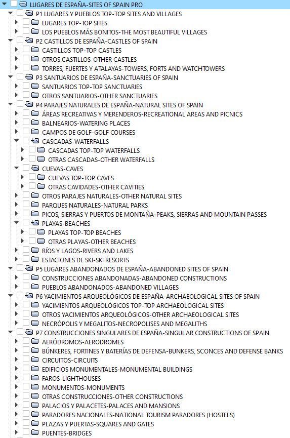
Packs included in SITES OF SPAIN allow you to visualize all those thousands of Points of Interest (POIs) on the map as Waypoints (WPT) with their names and geographical coordinates.
(Edition 23)
includes more than
33.000 Sites*
(33.000 Waypoints)!*

Sites are classified into different categories, which can be easily identified by a characteristic icon.
This is the structure of SITES OF SPAIN PRO and the icons that represent each one of the categories of the sites*:
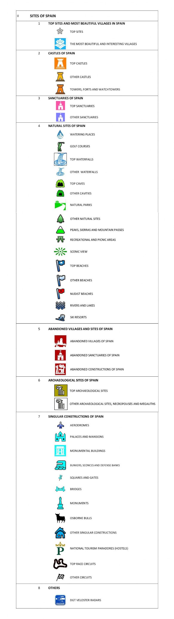
* Note: The shape and colors of the icons may vary depending on the file format and the application used to display the maps. It is recommended to use KML files with the free map viewers "Maps of Spain" of the IGN or "Google Earth" to see them exactly as they appear here.
SITES OF SPAIN PRO now also includes the location of Picnic and Recreational Areas, the National Tourism Paradors of Spain, the Racing Circuits, the Nudist Beaches and even the Osborne Bulls! (  )
)
If we upload the SITES OF SPAIN PRO file to a map viewer like Google Earth, let's see what happens:
The thousands of points of interest that SITES OF SPAIN PRO invites you to explore appear throughout the Spanish territory, represented by icons of different shapes and colors and with the name of each place*. This allows you to quickly and conveniently visualize which interesting sites are located in each area, so you don't miss any!
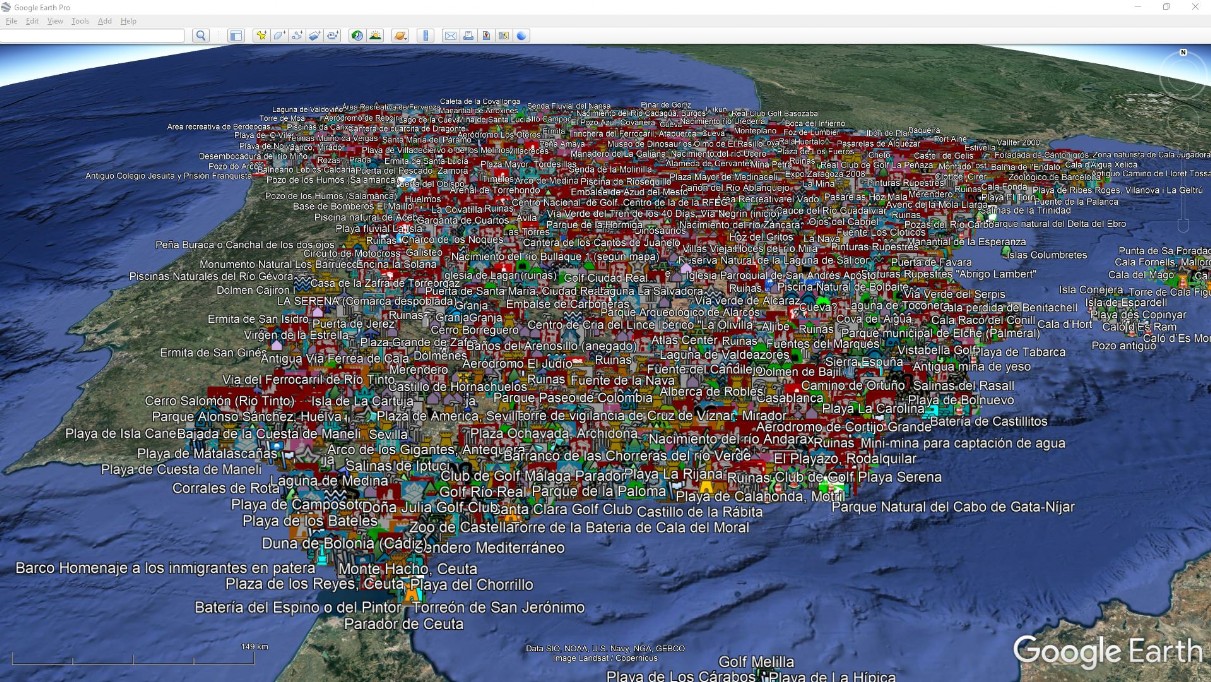
View with all the Packs loaded.
*Note: High-altitude views in Google Earth only show some of the drawing pins, not all. Packs can be displayed or hidden at will (in viewers that support it).
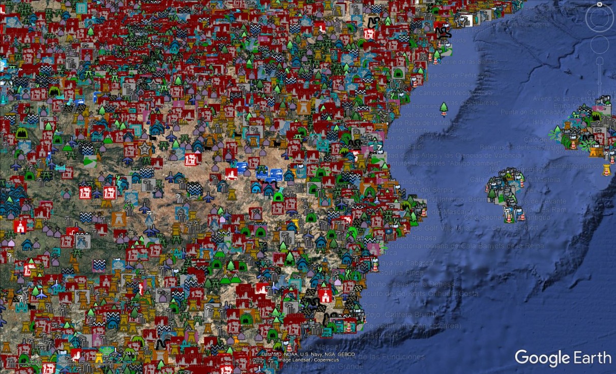
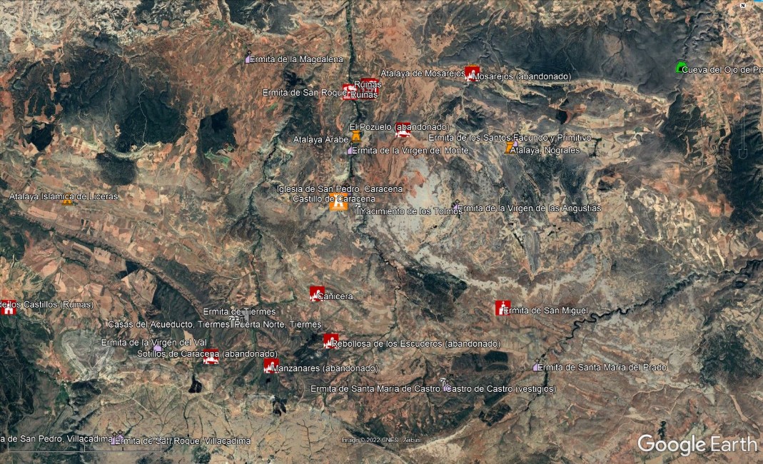
If we expand any area of the map (with all the packs loaded), we see it better:
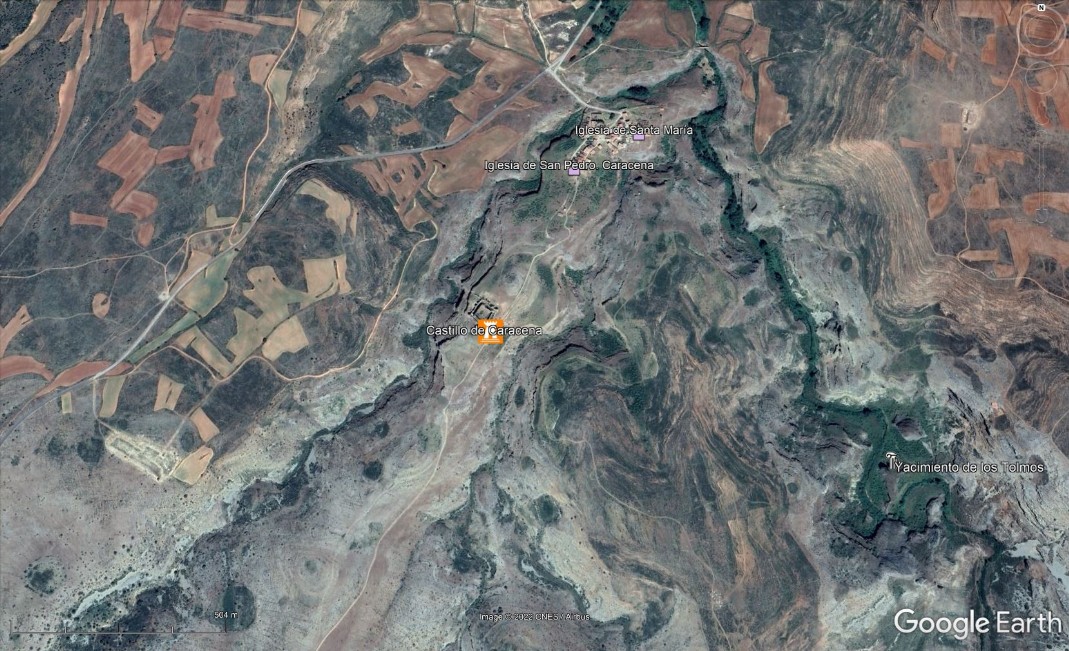
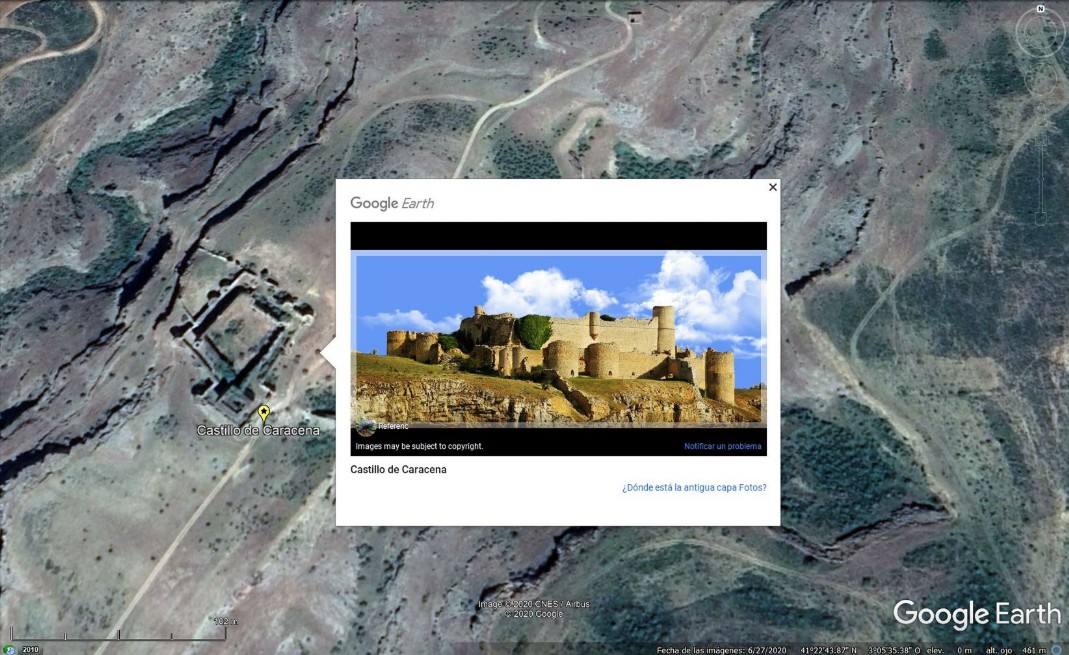
Zooming further, we would reach the specific site of our interest. In this example, it would be the evocative Castle of Caracena:
What is interesting about this tool is that,
thanks to SITES OF SPAIN PRO we do not only discover a beautiful castle like Caracena's, but also, quickly and effortlessly, we are able to identify that there are many more interesting places very close to it: two archaeological sites (Tiermes and Los Tormos), some beautiful hermitages (San Pedro, San Roque, El Monte, ...) and several abandoned villages (El Pozuelo, Cañicera, Rebollosa de los Escuderos, etc.), which most likely would have gone unnoticed for us if we did not have the tool SITES OF SPAIN PRO.
You couldn't have this information so easy, convenient and quickly any other way, not even with Google Maps because plenty of the interesting sites shown by SITES OF SPAIN PRO
not even appear clearly in most of the maps!
FANTASTIC!
That's the truly useful and interesting thing that brings
THAT'S GREAT!
You can't miss it!