


The ultimate tool to explore Spain!
How to use it
To use SITES OF SPAIN PRO, you will simply have to upload the file with the full version or the specific files of the packs of your interest in a GPS navigator or map viewer able to import location files by geographical coordinates in KML format, such as the files of the tool SITES OF SPAIN PRO.
Otherwise, you would have to convert the KML files of SITES OF SPAIN PRO to the specific format supported by your map viewer or GPS navigator. To convert files to different formats, you can use an also free tool like GPS Trackmaker® Free (available on https://www.trackmaker.com) that is compatible with more than 160 GPS models, including Garmin, Magellan and others.
From here, we recommend to use the map viewer "Mapas de España" of the Spanish National Geographic Institute (IGN) (based in "OruxMaps"), that can also be used in English language, or "OruxMaps" itself, both available in the Google Play Store. Both work identically and have the same user interface.
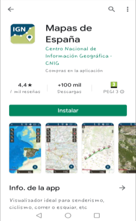
"Mapas de España" is free and you can get it from the Google Play Store, simply by typing in the browser "IGN" or "Mapas de España". (Make sure you don't confuse it with the basic orange version).
It is a very useful and very powerful tool that allows you to perfectly manage all the valuable information included in SITES OF SPAIN PRO while visualizing a collection of maps of the Spanish territory with a very pleasant and intuitive design.
Map viewer "Mapas de España" (and "OruxMaps" also) allow to obtain the navigation instructions to the waypoint selected by the user directly on the map for the GPS navigator of his choice (Google Maps, Sygic, Waze, etc.).
Also allow to use the offline GPS navigation assistants "GraphHopper" (recommended)* or "Broute", integrated in the map viewer itself, to generate and visualize in it the recommended offroad route to reach the chosen point from our current GPS position, with visual and voice navigation instructions, which even show by colors the slopes of the terrain to be traveled.
*Requires file downloading and installing (file "europe_spain.ghz" for the browser "GraphHopper"), free and easy to obtain. The viewer "Mapas de España" itself tells you how to download it the first time you want to use the "GraphHopper" navigation assitant. Once the file is automatically downloaded and unzipped, simply go to the map viewer menu at "Settings/App storage/Graphhopper Offline Address" and select the "europe_spain-gh" file (in the directory: "storage/emulated/0/oruxmaps/graphhopper/europe_spain-gh.
And that's it!, it should work. Don't forget to turn on GPS positioning in the map viewer. The red arrowhead must appear indicating your position on the map...
To also visualize the different slopes of the route tracks using colors, you need the DEM altitude files for Spain saved on your device and indicate the map viewer where they are stored: Go to "Settings/Maps/Directory for DEM files:" and indicate to the viewer where you have them saved. We recommend to store the DEM (.hgt) files into a specific folder crated in the "IGN" (or "Oruxmaps") directory itself.
Just great!
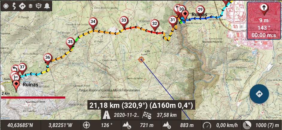
Example of offroad navigation route generated by "GraphHopper" on the map viewer "Mapas de España" (Android Smartphone).
Different colors show the different terrain slopes of the track.
If you prefer, for the map viewer "Mapas de España" you can also download the offline maps of Spain, the whole country or only the areas that interest you
(in .mbtiles
format
),
to have them permanently stored in your smartphone or tablet and avoid needing network data coverage.
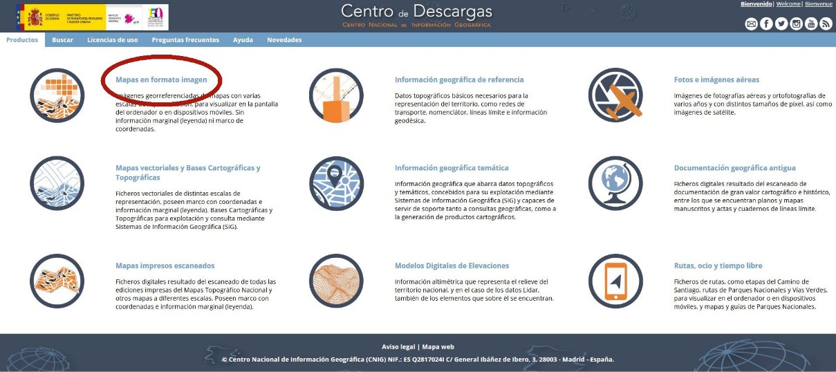
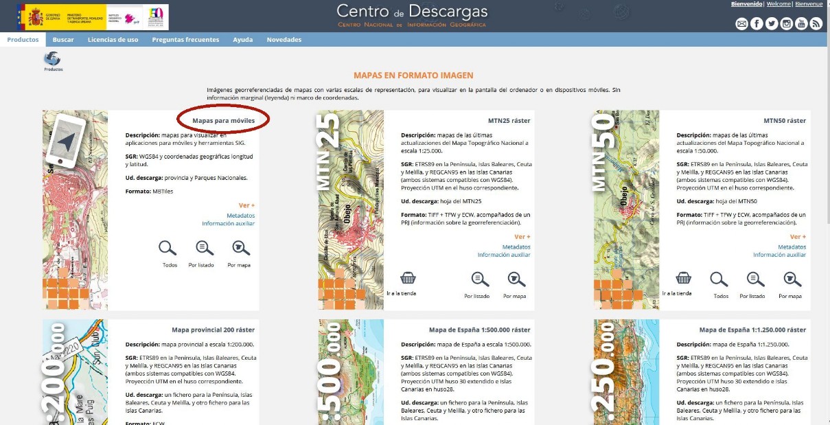
Download them for free from the CNIG download center entering here:
Then, select "Mapas en formato imagen" ("Maps in image format"):
and then, in "Mapas para móviles" ("Mobile maps") select "Todos" ("All"):
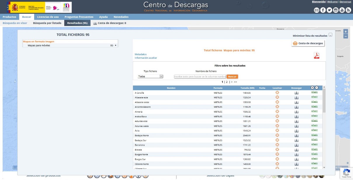
Choose the provincial maps you want to download. You'll need to pre-download and install a Java application to do so. Don't worry, the system will guide you step by step.
Once you have downloaded the maps, you will have to copy them to your smartphone or tablet and tell the application "Mapas de España" where they are: to do that you have to go to "Settings/Maps/Maps Directory". By default, the application will search for them in the "mapfiles" directory inside the IGN folder, created when the app is installed on your smartphone/tablet. (IGN/mapfiles).
Once the application
"Mapas de España", is installed, you will have to import and open the tool SITES OF SPAIN PRO
with it
.
You can directly download the complete file of SITES OF SPAIN PRO in the tab "BUY & DOWNLOAD" of this website, or clicking here.
The App "Mapas de España" of the Spanish IGN can import files in KML format, so once the file is downloaded and saved in your smartphone, you will have to tell the application where it's located, so that it can open it. By default, it will look for it in the IGN/overlay directory. We recommend that you keep it there. If you want another location for the file, you will need to tell the application where to look for it, going to Settings/Maps/Settings KML layers.
SITES OF SPAIN PRO
"Mapas de España"
"Mapas de España"
Finally, to open the file with the application and enjoy all the possibilities it offers you, simply:
"Mapas de España"
Deploy the "Mapas de España" application menu from the left and choose the option "Load KML/SHP Layer". Select the specific file of SITES OF SPAIN PRO you want to open and that's it!.
To work comfortably with the file you will have to configure to your liking the display of the waypoints on the map (size of icons and text). You can do it in "General Settings/Visual Elements". It´s also very important for it to indicate the App at what zoom level the waypoint names shall be displayed.
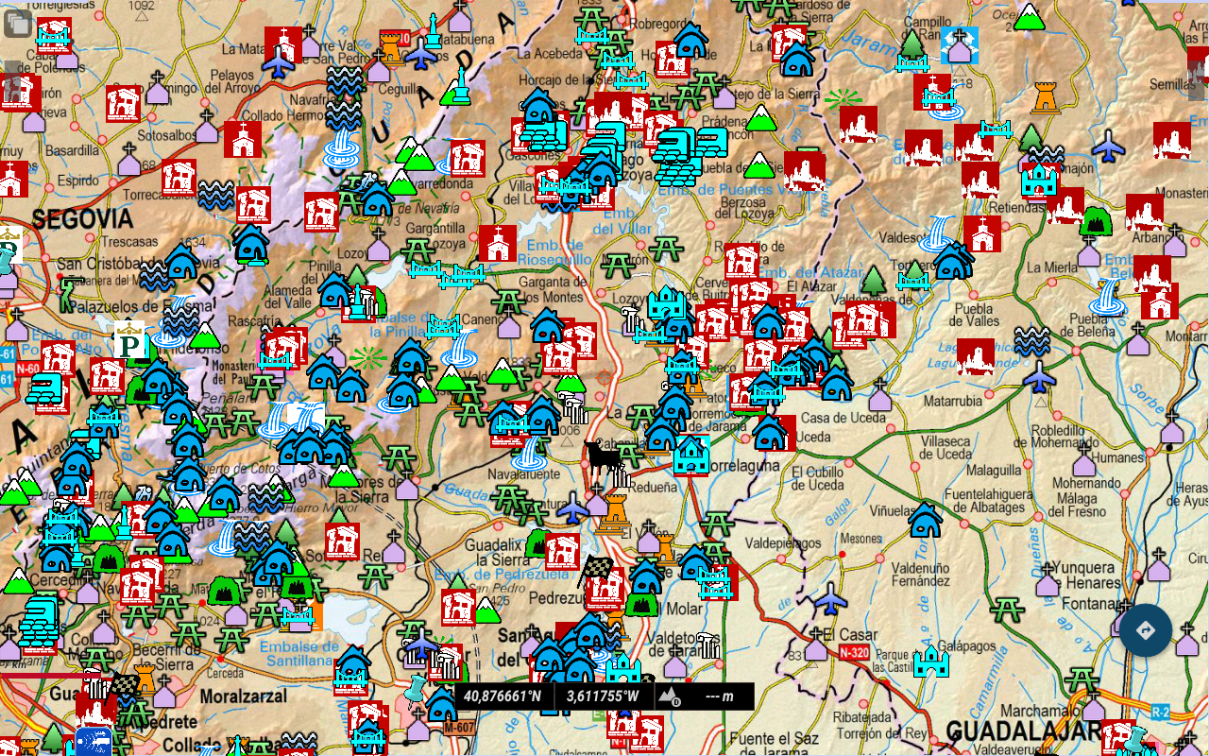
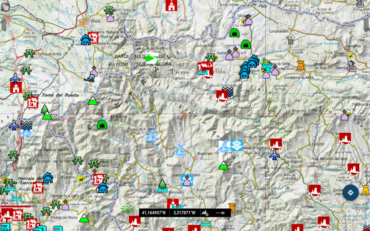
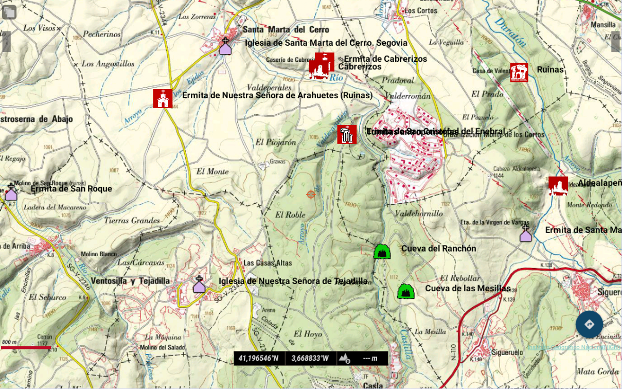
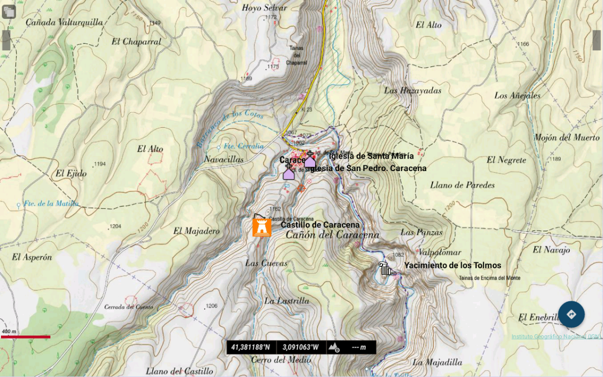
With all the packs installed, you should see something like this (for different zoom levels):
Ready!
Enjoy it!
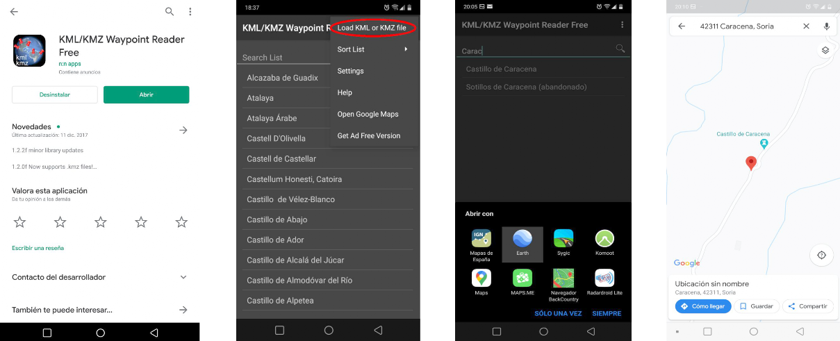
Finally, we also recommend you to use a Waypoint reader, such as "KMZ/KML Waypoint Reader" or "GPX Waypoint Reader", which you can download for free and install on your smartphone or tablet from the Google Play Store or Apple Store, and so get the whole Waypoint list of SITES OF SPAIN PRO. With this list, you have immediately at your disposal the navigation instructions to reach any place of SITES OF SPAIN PRO (those accessible by vehicle), using the GPS navigator of your choice installed on your smartphone or tablet.
Great!
Download "KMZ/KML Waypoint Reader" or "GPX Waypoint Reader" from the Google Play Store and install the app in your smartphone or tablet.
Open the app, load the SITES OF SPAIN PRO file in the corresponding KML or GPX format and ...
That's it!
You have already the SITES OF SPAIN PRO POI list to get direct navigation instructions to them!
Try it, you'll love it!
It's very easy to use and really, really useful!